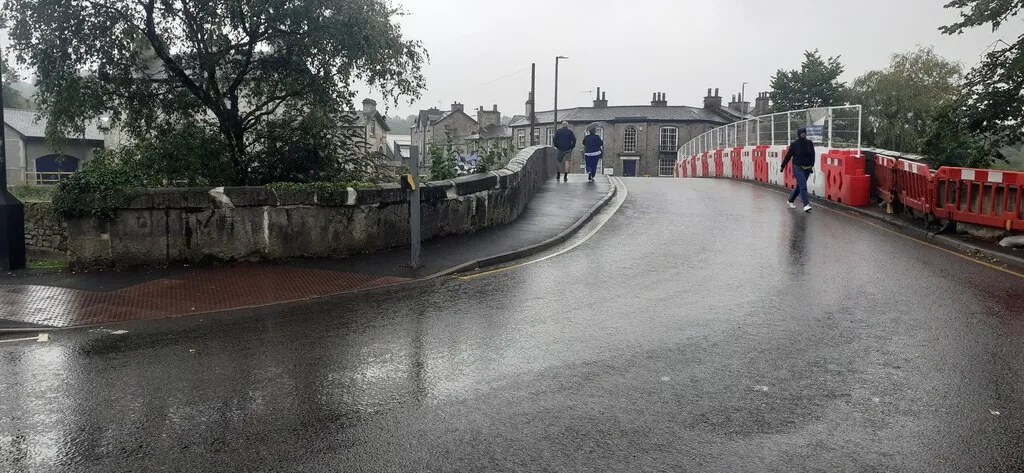

Burneside Road is shut to all traffic into early November. Nether Bridge closes on 12 October, the night A590 closures at Meathop begin. Full list.
Kendal has two motorway junctions, one river running through the middle of it, and a flood defence scheme that has been rebuilding the riverbanks for years. Most local delays come from one of those three things. This page lists the Kendal roadworks running now and booked in for the next few weeks, and where to check before you set off.
Last checked Saturday 3 October 2026. We read every temporary traffic order for the south Lakes published on the Public Notice Portal between 17 September and 1 October, National Highways’ north west schedule and Northern’s engineering list.
The short version:
- Burneside Road, Burneside: shut to all traffic, walkers included, for about five weeks from 28 September.
- Nether Bridge, Kendal: shut to vehicles for up to five days from Monday 12 October.
- A590 Stakes Moss to Witherslack: overnight closures from 12 October to the end of November, with Meathop Roundabout closed.
- Aynam Road, Kendal: 20mph for about nine months, in force since 21 September.
- M6 junctions 35 to 36: lane 3 shut both ways and 40mph, to 11 December.
Burneside Road is shut for five weeks
The council has made an order closing Burneside Road in Burneside to all traffic for utility works. That means vehicles, pedestrians and cyclists. It came into operation on Monday 28 September, and the council expects to need it for about five weeks, which points to the start of November.
- The closed length is about 370 metres, starting about 60 metres south east of the Carlingdale junction.
- The signed route for all traffic runs via the open parts of Burneside Road, Windermere Road (A5284), the A591 and Hollins Lane.
- As with every order of this kind, it applies only when the signs are out.
- The reference is TTROW/20139.
This is the road between Kendal and Burneside, so anyone who walks, cycles or drives it between the two needs the A591 for the next month.
Source: the made order of 24 September.
Nether Bridge shuts for five days from 12 October
Nether Bridge will be closed to all vehicles from Monday 12 October for a maximum of five days, 24 hours a day. A 10-metre section of the southern parapet wall is being rebuilt. The wall was demolished in a traffic incident in June.
- The signed diversion runs via Romney Bridge and Milnthorpe Road.
- Extra signs will keep HGVs off Parkside Road, because of the 13ft 3in height restriction at the railway bridge.
- Pedestrians and cyclists keep the bridge, using the northern footway.
- The southern footway stays closed for several weeks after the road reopens, because covers have to protect the lime mortar while it cures.
Source: the council’s announcement of 9 September, which still gives the same dates on 3 October.
One thing is still missing. None of the traffic orders published between 17 September and 1 October covers Nether Bridge. The diversion route only becomes legally published when that order appears. The council’s announcement is the only firm source for the dates until then. We set out why the repair takes this shape in our report on the Nether Bridge closure.
The A590 at Meathop closes overnight from the same day
The A590 resurfacing between Stakes Moss and Witherslack is back on National Highways’ schedule. It had dropped off in mid September. The new dates are 12 October to the end of November 2026.
- Overnight closures, 9pm to 6am, Monday to Friday only, on the single carriageway between Stakes Moss and Witherslack.
- Meathop Roundabout is listed for full closure while resurfacing takes place there.
- The signed diversion follows the A592 and A591. That is via Windermere, a long way round for anyone heading to Grange, Cartmel or Barrow at night.
- The westbound dual carriageway, Witherslack to Meathop, has a contraflow throughout the works.
- Emergency services access is maintained.
Source: National Highways’ north west maintenance schemes.
Two more A590 jobs sit alongside it:
- Ulverston, 12 to 31 October. Full overnight closures, 8pm to 6am, Monday to Friday, between Booths roundabout and Park Road roundabout, with a convoy through the town and a diversion via the A595 and A5092. Same source.
- B5277 roundabout to Witherslack, evening of Wednesday 4 November. National Highways intends to close the A590 both ways from 6pm to 8pm while power lines are strung across it. It warns the work may run into later periods if it is not finished. Source: the National Highways notice of 24 September.
Aynam Road is 20mph, and stays that way for nine months
The council made a temporary 20mph order for Aynam Road on 17 September. It came into operation on Monday 21 September and is anticipated to be required for nine months, into the summer of 2027.
- It runs from the Bridge Street junction for about 730 metres.
- The reason given is flood defence works on the Kendal Flood Risk Management Scheme.
- The order can legally run for eighteen months. Nine months is the council’s expectation, not a limit.
- Reference TTROW/21002.
Aynam Road carries the A65 along the east bank of the Kent into the one-way system, so this adds time to every trip into Kendal from the south. Source: the made order of 17 September.
The M6 barrier scheme runs to 11 December
National Highways is replacing the central reservation barrier on the M6 near Burton-in-Kendal, starting at Borwick Lane overbridge. The scheme runs to Friday 11 December 2026. Junction 36 is Kendal’s junction.
For the whole scheme there is a lane 3 closure in both directions and a 40mph limit. That is the part Kendal drivers meet every day.
Every overnight phase National Highways has published is now behind us. The last was lanes 2 and 3 shut northbound, 28 September to 2 October. Since our last check the schedule also gained one extra full overnight closure of the southbound carriageway between junctions 36 and 35, on 25 September. On 3 October no further overnight closures were listed. Source: National Highways’ north west maintenance schemes.
When the M6 shuts near Kendal, the A6 through the town becomes the alternative.
This weekend and next week in Kendal
All of these are made orders unless marked otherwise.
- Parkside Road, Sunday 4 October, 9.30am to 2.30pm only. Closed for 25 metres either side of the centre line of the bridge, for vegetation clearance. Pedestrians and dismounted cyclists keep a way across. The signed diversion runs Singleton Park Road, Hayclose Lane, the B6254 Oxenholme Road, the A65 Burton Road and the A65 Lound Road. Ref TTROW/20209, made 1 October.
- Calder Drive, from Monday 5 October, about 5 days. Closed for 35 metres east of Sandylands Road. Diversion via Sandylands Road, Peat Lane and the rest of Calder Drive. Ref TTROW/19844, made 1 October.
- C5071 Natland, from Monday 5 October. Closed to all traffic for 200 metres north of the U5629. Diversion via the A65 Burton Road and the C5075. The order gives the duration as “5 days/weeks”, the council’s own wording, which settles nothing. Ref TTROW/18222, made 1 October.
- C5071 Natland again, Tuesday 13 October, about 1 day. A separate closure of 305 metres south of St Marks Fold. Ref TTROW/20332, in the made order of 17 September.
- Footpath 536026, from Monday 5 October, about 2 weeks. The whole path is closed to walkers while VolkerStevin, one of the flood scheme’s joint venture partners, carries out ground survey investigations. The order says no alternative is available for pedestrians. The portal gives an estimated end of 19 October. Made 1 October.
- Captain French Lane, from Monday 19 October, about 5 days. Proposed. No waiting or loading at any time, blue badges included, on 30 metres of the south side, about 75 metres south east of East View. Ref TTROW/20733, advertised 1 October.
Powson Bridge is shut until about early November
The C5069 crosses the M6 on Powson Bridge, just north of junction 37 near Lambrigg. The parapets are being replaced and the bridge has been shut to vehicles since 1 September.
- Closed for 25 metres either side of the bridge. Pedestrians and dismounted cyclists keep a way across.
- Diversion via the C5070, C5068 Docker Lane, C5069 Kinn Road, the A684 and C5069 Old Scotch Road.
- The council expects to need the order for about 9 weeks, which points to early November. Reference TTROW/19935.
In August National Highways gave an end date of 18 December. That date has not reappeared on its schedule, which on 3 October still made no mention of Powson. Source: the council’s made order of 27 August.
Hayclose Lane is on temporary speed limits to mid December
The council’s order of 24 August imposes temporary speed limits on Hayclose Lane for utility works, for about 16 weeks:
- 40mph for about 400 metres south west of the A684 junction.
- 40mph for about 400 metres north of the Oxenholme Road (B6254) junction.
- 30mph on the 615 metres in between.
Reference TTROW/19960, in the made order.
Ten roads including five stretches of the A591, to about 14 October
The South Lakeland Temporary Prohibition of All Traffic (No. 2) Order 2026 came into operation on 14 September for about one month. It shuts roads to all traffic, including pedestrians and cyclists, but only as and when the signs are out. On the council’s own expectation it finishes around 14 October.
| Road | Extent | Ref |
|---|---|---|
| A591 Skelghyll Lane, Windermere | From 400m south east of Borrans Road (A5075) to the C5003 | TTROW/20053 |
| A591 Rydal Road, Rydal | From 520m north west of Greenbank Road, 2.3 km | TTROW/20056 |
| A591, Troutbeck Bridge | From 330m north west of Keldwyth Drive, 640m | TTROW/20058 |
| A591 Ambleside Road, Windermere | From Rayrigg Road (A592), 970m | TTROW/20064 |
| A591, Staveley | From Danes Road to Kendal Road (C5108) | TTROW/20069 |
| A592 Rayrigg Road, Windermere | From Ambleside Road (A591) to Rayrigg Rise | TTROW/20066 |
| A595, Foxfield | From the C5009, 3.4 km | TTROW/20062 |
| A683, Barbon | From the C5080, 2.6 km | TTROW/20063 |
| Church Street, Beetham | From the U5435, 470m | TTROW/20070 |
| Church Street, Beetham | From the B5360, given as 15 km | TTROW/20059 |
Source: the made order of 10 September.
- The published A591 diversions are enormous. Northbound non-motorway traffic is signed via the A592, A5091 and the A66 at Keswick.
- A closure at Barbon sends traffic through the middle of Kendal. The southbound diversion runs Lound Road, Kirkland, Highgate, Lowther Street, New Road, Blackhall Road, Sandes Avenue, Longpool and Appleby Road.
- The second Beetham entry does not add up. TTROW/20059 is given as 15 km, with a Windermere-area diversion. Beetham has no 15 km of Church Street, so treat that extent as an error in the paperwork.
Around the south Lakes in the next three weeks
Orders the council has already made. These are decisions:
- A5074 Main Road, Windermere, Sunday 4 October, about 1 day. Closed to all traffic, including pedestrians and cyclists, for 225 metres north of Crescent Road, in the middle of Windermere. The signed route runs Ellerthwaite Square, New Road, Lake Road, Crag Brow, Rayrigg Road, Ambleside Road and Elleray Road. Ref TTROW/20324, made 1 October.
- B5285 Hawkshead, from Monday 5 October, about 3 days. Closed to all traffic for 625 metres, 1.1 km south east of the U5025. Diversion via the B5285, C5027 and C5026. Ref TTROW/20725. The same order closes 215 metres of the U5215 at Oxen Park from 8 October for about 5 days. Both made 1 October.
- Lake Road, Coniston, two nights from Monday 5 October, 7pm to 6am. 125 metres south east of Beck Yeat, with no suitable alternative route for vehicles. Ref TTROW/20298.
- U5340, Leasgill, from Monday 5 October, about 5 days. 115 metres south east of the C5072, again with no suitable alternative route for vehicles. Ref TTROW/20376. Coniston and Leasgill are both in the made orders of 17 September.
- A593 Torver, overnight on Tuesday 6 October, 10pm to 5am. About 4 km closed north east of the A5084 to move an abnormal load. The diversion is via the A591, A5074, A590, A5092 and A5084. Ref TTROW/20472, made 1 October.
- B5343 Chapel Stile and U5527 Little Langdale, from 29 September. Now made. Four kilometres of the B5343 and 3.5 km of the U5527, with the way round via the C5004. The order gives this phase’s duration as “10 days/weeks”. A second phase, on the U5527 from the A593 and all of the U5003, runs from 13 October for about 2 weeks. Refs TTROW/19163 and TTROW/19146, made 24 September.
- C5048 Underbarrow, west of Kendal, from 28 September, about 12 days, and B6254 Kearswick, from 29 September, about 2 weeks. Both still running on their published durations. Refs TTROW/20124 and TTROW/20122, in the made order of 10 September.
- Sunny Bank, Windermere, from Monday 26 October, about 5 days. Its entire length from Queens Drive, with the way round via Queens Drive and Prince’s Road. Ref TTROW/20040, in the Natland order made 1 October.
Orders the council has advertised but not yet made. These are intentions, and they can change:
- C5059 Station Road, Staveley, from Monday 12 October, about 5 days. Abbey Bridge repairs close 20 metres south of Main Street to all traffic, walkers included. The signed route is Main Street, the A591 Kendal Road, the B5284 Crook Road and the rest of the C5059. Ref TTRO/W/20405, advertised 24 September.
- Easedale Road, Grasmere, from 12 October, about 3 days. 35 metres by Highfield House, with no suitable alternative route for vehicles. Ref TTROW/20401, advertised 24 September.
- A593 Coniston, Sunday 11 October, about 1 day. Only 25 metres, from the U5005, but the signed diversion runs the A593, A5084, A5092, A590, A592, A591 and A5075. Ref TTROW/20294, advertised 24 September.
- C5040 Park View, Cartmel, from 12 October, about 8 weeks. 255 metres closed to all traffic from the U5176. Diversion via Greenbank Lane, Aynsome Lane and the C5041. Ref TTROW/20423, advertised 24 September.
- School Hill, Lindale and Cheapside, Ambleside, Thursday 15 October, about 1 day each. The same order closes 90 metres of the C5028 at Near and Far Sawrey from 7 December for about 2 weeks. Refs TTROW/20410, TTROW/20573 and TTROW/20562, advertised 24 September.
- B5343 Chapel Stile, no waiting or loading from 9 October. On both sides for 125 metres west of Thrang Brow, because of the dangerous condition of a retaining structure. It follows emergency notices of 28 August and 18 September. Ref TTROW/21022, advertised 1 October.
- B5285 Near and Far Sawrey, from Tuesday 20 October, about 12 days. 870 metres north west of the C5028. Diversion via the B5285, C5027, C5026 and C5028. Ref TTROW/20271, advertised 1 October.
- The Green and Nook Lane, Ambleside, Tuesday 20 October, about 1 day. Ref TTROW/20487, advertised 1 October.
- U5475 Sedbergh, from 19 October, about 2 days, and C5098 Hale, Friday 23 October, about 1 day. Hale is 530 metres from Leighton Beck Road, with a diversion via the A6. Refs TTROW/20536 and TTRROW/20552 (the council’s spelling), Sedbergh and Hale.
On the trunk roads:
- A590 Stakes Moss to Witherslack, 12 October to the end of November, set out above.
- M6 junctions 35 to 36, to 11 December. Lane 3 closed both ways and 40mph.
- M6 junctions 32 to 33 northbound, to 29 October. Bridge repairs at Whittingham Lane, near Preston, with a lane closure throughout and overnight full closures on Thursdays and Saturdays, 11pm to 6am.
- M6 Lune Gorge bridges, to the end of November. National Highways is removing and sealing asbestos-containing materials on the Tebay and Borrowbeck bridges, subject to weather and river levels. The footpath closure south of Tebay ended on 30 September. Source: the M6 Lune Gorge structures page.
Gone from this page since the last check, all finished on their published durations: the B6254 and U5631 closures at Oxenholme, Brigsteer Road, the Skelwith Bridge, Newby Bridge and Blue Hill Road jobs, the Lindale closures, Old Lake Road in Ambleside, and the twenty-road No. 14 order, which lapsed around 23 September. We found no new order reviving any of them.
Queries on council roadworks go to the Highways Hotline on 0300 373 3300 or 0300 373 3306.
Trains: still nothing booked on the Lakes Line. On 3 October, Northern’s engineering and disruption page named no planned work in October or November on the Windermere branch, through Oxenholme or at Lancaster. Check with Avanti West Coast for the main line before you travel.
The flood scheme, and what it closes
The Kendal Flood Risk Management Scheme is the reason for most riverside disruption in the town. It is an Environment Agency project delivered by the contractor VBA, and it exists because Storm Desmond in December 2015 hit 2,276 properties in Kendal, either by flooding them directly or by cutting them off when infrastructure failed.
Phase 1 built 6km of linear flood defences along the Rivers Kent and Mint, using walls, embankments and 14 flood gates, plus a pumping station at Gooseholme where Stock Beck meets the Kent. VolkerStevin, one of the joint venture partners, puts the completed protection at 1,480 homes, 82 community facilities and 1,150 businesses.
For getting about, the practical points are these:
- All road bridges over the Kent stay open throughout construction, under the traffic management plan agreed with the council. Only one road closure, at Waterside, was planned as a full closure.
- Riverside footpaths close in sections while work moves along each reach, with signed diversions. If you walk the river into town, check before you set off rather than at the barrier.
- Berners Close car park has limited availability because of construction work, according to the council’s own car park listing.
The scheme has also added new and improved walking and cycling routes along the river, and restored land at Beezon Fields and Mintsfeet, so some of what looks like disruption is a path that is about to get better.
Key routes, and when they bite
- M6 junctions 36 and 37 are Kendal’s motorway access. The council’s own flood scheme documents make the point plainly: Kendal’s closeness to the M6 makes the town and the A6 a critical diversion route when the motorway closes northbound or southbound, and the M6 from junction 36 upwards is affected fairly regularly through the winter. A closure on the M6 becomes a Kendal town-centre problem within the hour.
- A591 to Windermere and Ambleside is the tourist artery. In school holidays and on fine summer weekends it queues, particularly on the approach to Windermere.
- A590 to the south west is single carriageway for much of its length, which is why National Highways works on it overnight and with convoys rather than closing it.
- A6 north to Shap is the high route and the first to suffer in snow and ice.
- A684 east to Sedbergh and A685 to Tebay are the Dales-side roads, both narrow in places. The A685 also carries the diversion for the Paddy Lane closure at Meal Bank.
Parking in Kendal
The busiest car park in town is being relined. The council scheduled the work to start on Monday 28 September at the Westmorland Shopping Centre car park, widening bays from 2.4 metres to 2.6 metres, and to more than 3 metres between some of the structural pillars. The work is done floor by floor, with temporary closures only on the level being worked on, and the council says the total number of spaces will fall. A wider review of parking across Kendal is planned this year. Source: the council’s announcement of 9 September, and our report on the wider bays.
Council car parks in the town are chargeable 8am to 6pm as standard, with Broad Street and Braithwaite Fold running to 8pm. All are open 24 hours. Each has its own Pay by Phone code: Blackhall Road is 9860, Broad Street 9865 and 9879, Brewery Street 9927, Beetham Road 9924, Buxton Place 9928, Berners Close 9866 and Bluebell Lane 805796. The Brewery Arts car park applies overnight charges.
For a comparison point on price, take the small pay and display car park at Abbot Hall on the riverside, run by Cumbria Parking Services. Its tariff is:
- up to 1 hour: £2.00
- up to 2 hours: £3.30
- up to 3 hours: £4.60
- up to 4 hours: £5.40
- to the end of the day: £7.50
If you are catching a train, the parking situation is lopsided. Kendal station has four free spaces. Oxenholme has 145 spaces at £12.50 a day, or £5.50 at weekends. Details of both are on our trains to London page.
Where to check before you travel
- One.network is the map Westmorland and Furness Council uses to publish roadworks. You can search by town, street or postcode and look up to twelve months ahead.
- National Highways publishes the M6, A590, A66 and A595 schemes, which the council map does not always carry.
- The Public Notice Portal carries the statutory temporary traffic regulation orders. This is where the closures above are legally advertised, and it is the only place the diversion routes are published in full.
- The council’s flood scheme page for riverside works.
More Kendal local information: house prices, trains to London, planning news and things to do in Kendal.
Have your say